
While I have your attention - CLIMATE CHANGE IS REAL
Nothing bird related here. Hurricane Irma became one of the strongest Hurricanes ever recorded in the Atlantic today (by wind).... Rather than over-tweet or over-video, I decided to do a boring old blog post to show off some of the insane images I've found online... Hopefully they are saved, and don't update with time - but no promises!!!
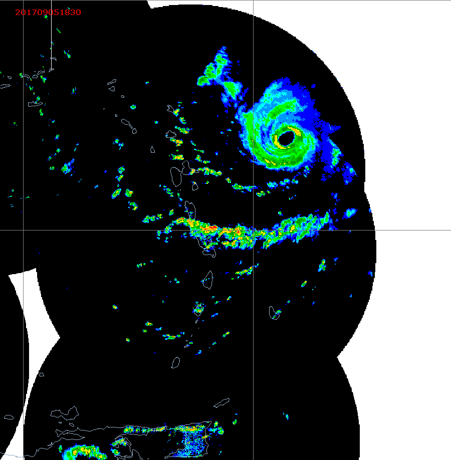
Radar
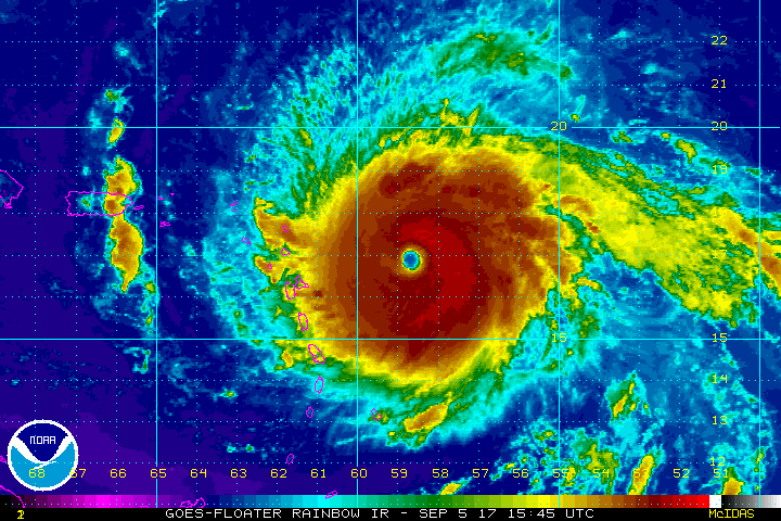
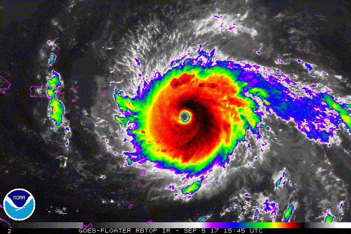

Check here for some insane imaegs from the new GOES16 sat!
https://twitter.com/NOAASatellites/status/905061958944256000
https://twitter.com/NASA_SPoRT/status/905169228000583681


Models are not looking promising for Great Lakes birders, but they continue to flop around enough that there is hope... I'll put off an update video until late tomorrow or early Thursday to see if the new data helps narrow down the potential track... Playing the waiting game! More importantly, thoughts to those in the path of this monster.
I should have put this in the post - but now that Irma has started the WNW motion, it's possible the 00z runs of the Euro and GFS will be a better indication on where this beast is headed in the long term (than any previous day)
ReplyDelete